Why Construction Superintendents Are Turning to Geographic Information Systems (GIS) for Smarter Field Operations
Table of Contents:
What Are Geographic Information Systems (GIS) and Why Do They Matter for Superintendents?
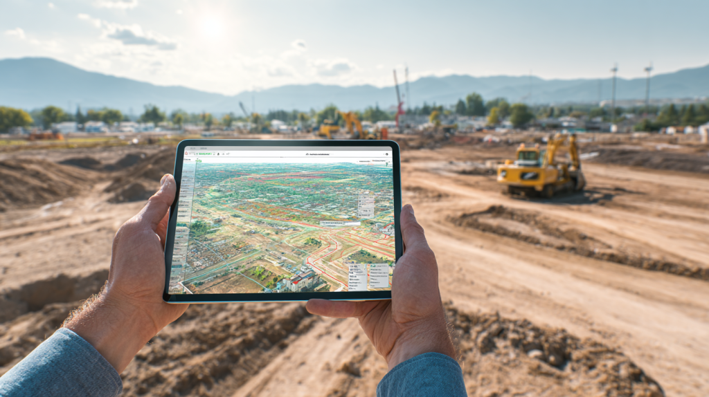
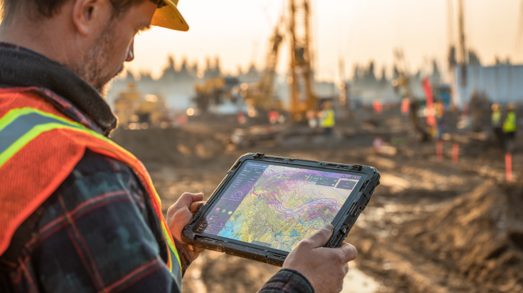
Geographic Information Systems (GIS) are digital tools that allow construction professionals to visualize, analyze, and manage spatial data. On the jobsite, GIS maps help superintendents and field teams understand what’s happening where—down to the square foot. From marking utility lines to identifying access paths and staging areas, GIS enhances situational awareness and drives better decision-making in the field.
Unlike printed plans or static PDFs, GIS delivers real-time, interactive site maps that display layers of critical information. Superintendents can use these maps to identify work zones, track progress, flag hazards, and communicate more clearly with crews and subcontractors. With GIS, you’re not just looking at a map—you’re managing the jobsite with live data that supports smarter, safer operations.
What makes GIS especially valuable for superintendents is its mobility. With a tablet or smartphone, they can access layered maps from anywhere onsite, zoom into specific zones, tag updates, and share visual notes. This turns everyday coordination tasks—like staging, layout, or walkthroughs—into streamlined workflows.
Top Benefits of GIS for Superintendents
- Improves visibility into real-time site conditions and progress
- Reduces layout and coordination errors in high-traffic areas
- Enhances crew communication with spatially tagged updates
- Supports faster, data-driven decision-making in the field
Best Practices for Adopting GIS in Field Leadership
- Use GIS tools that work offline and sync automatically
- Review map layers before daily huddles or shift changes
- Encourage subs to tag issues or updates to map locations
- Update GIS data weekly to reflect changes and keep records current
For superintendents managing the chaos of daily field activity, GIS offers a clearer path to jobsite control—one that’s visual, mobile, and built for action.
How GIS Helps Superintendents Prevent Errors and Conflicts in the Field
Mistakes in the field are costly. Whether it’s a trench dug in the wrong location or a crew working in a restricted zone, even small missteps can create delays, rework, and safety risks. Geographic Information Systems (GIS) help superintendents prevent these problems by giving them an interactive, real-time view of the jobsite.
With GIS, superintendents can overlay utility locations, safety zones, access routes, and task areas on a single map. This means they can spot potential clashes before they happen—like overlapping trade activities or blocked delivery paths. They can also monitor progress by zone, making it easier to see where the schedule is slipping and where more resources might be needed.
GIS also supports better communication with subcontractors. Instead of relying on verbal instructions or email chains, superintendents can assign tasks and provide updates directly on the map. Crews can see exactly where they need to work, what the constraints are, and when work needs to be completed.
Top Benefits for Reducing Field Errors with GIS
- Identifies spatial conflicts before work begins
- Reduces confusion about task locations and boundaries
- Improves accountability with map-linked task assignments
- Speeds up issue resolution by visualizing field conditions
Best Practices for Avoiding Field Conflicts Using GIS
- Map all utility lines and restricted zones before site work starts
- Assign crews to clearly defined zones on shared maps
- Use symbols and color coding for task sequencing
- Walk the site with GIS maps to validate plans before issuing work
When superintendents can see the field in layers—not just on paper—they lead with more confidence and avoid costly field mistakes before they happen.
Why GIS Is Becoming a Must-Have Tool for Modern Jobsite Leadership
The role of the construction superintendent has evolved. It’s no longer enough to know the drawings and walk the site with a clipboard. Today’s superintendents are responsible for coordinating dozens of trades, managing dynamic schedules, maintaining safety, and responding to changes in real time. That’s why more and more are turning to Geographic Information Systems (GIS) to keep up.
GIS gives superintendents a real-time command center in their pocket. With mobile access to layered maps, they can check progress, assign work, tag issues, and communicate with the office—all without leaving the field. Instead of relying on memory or paperwork, they lead with data that’s spatially organized and always current.
The value of GIS goes beyond field execution. It also supports better planning, inspections, compliance tracking, and reporting. Superintendents can use GIS maps to prepare for safety walks, coordinate punch lists, or respond to RFIs with visual documentation. It’s not just a field tool—it’s a leadership tool.
Top Benefits of GIS for Modern Jobsite Managers
- Gives superintendents a centralized view of jobsite activity
- Reduces paperwork with digital, location-based updates
- Enhances transparency for owners, PMs, and inspectors
- Improves schedule management through zone-based tracking
Best Practices for Superintendents Adopting GIS
- Start with small GIS workflows like delivery tracking or layout zones
- Train lead foremen to interact with maps during coordination
- Use GIS to support daily logs, RFIs, and quality control
- Share updates with office teams to maintain alignment
For superintendents managing complex builds under pressure, GIS delivers the visibility, structure, and speed they need to stay in control.

StruxHub: Revolutionizing Project Management in Large Commercial Construction
Key GIS Functions That Simplify Daily Jobsite Operations
Geographic Information Systems (GIS) aren’t just for preconstruction and planning—they’re becoming indispensable in the daily execution of field work. From site layout and equipment staging to shift handoffs and inspections, GIS offers superintendents the tools to simplify day-to-day operations with greater precision and less friction.
One of the most useful GIS functions is real-time mapping. Superintendents can view dynamic jobsite conditions as they change—what zones are active, which areas are restricted, and where delays are occurring. Instead of chasing updates, they get an instant, visual summary of the jobsite’s current status.
Other powerful GIS tools include tagging and annotation. With a few taps, field leaders can place notes, pin photos, or flag issues directly on the map. These markers are tied to specific coordinates, making it easy to share clear, visual instructions with crews, PMs, or inspectors. Over time, these map-based records also help build a history of jobsite activity that’s useful for quality control and project documentation.
Top Benefits of GIS for Daily Field Operations
- Reduces time spent on manual updates or field calls
- Keeps jobsite coordination visual and easy to understand
- Speeds up shift handoffs with clear task locations
- Builds a spatial history of field progress and issues
Best Practices for Using GIS to Manage Daily Site Work
- Start your day with a GIS map review during huddles
- Use annotations to log punch items and RFI zones
- Share visual updates with foremen at shift changes
- Update status layers daily to keep maps accurate
GIS brings clarity and structure to jobsite workflows—so superintendents can spend more time leading and less time chasing information.
How GIS Supports Safer Jobsite Conditions and Inspections
Jobsite safety depends on clear communication, hazard awareness, and fast response—and GIS supports all three. By mapping safety zones, access routes, and potential hazards, Geographic Information Systems help superintendents keep crews out of danger and improve the overall safety culture on site.
Before work begins, GIS can be used to mark high-risk areas like excavation zones, electrical routes, or areas with overhead crane activity. These are visible to every crew member on a mobile device or tablet, reducing the chances of accidental entry into unsafe areas. GIS can also be used to track safety checklists and inspection results by zone—making compliance more transparent and easier to manage.
When incidents do occur, GIS helps teams document them visually. Notes and photos can be pinned to the exact location of the event, making it easier to investigate and implement preventive measures. This spatial clarity improves accountability and simplifies reporting to safety officers or insurers.
Top Benefits of GIS for Safety and Inspections
- Makes hazard zones visible and accessible to all crews
- Improves inspection documentation with map-based records
- Reduces risk of unauthorized access to restricted areas
- Supports faster response to safety incidents and audits
Best Practices for Using GIS in Jobsite Safety
- Define safety zones clearly in GIS before work begins
- Use icons or color codes for different types of hazards
- Assign inspection tasks to map locations for easy tracking
- Keep inspection and incident logs spatially organized
GIS adds a layer of safety to the jobsite—not just by flagging risks, but by helping teams see and respond to them before problems occur.
Why GIS Helps Superintendents Deliver Projects More Efficiently
Meeting deadlines and maintaining quality are top priorities for every construction superintendent. GIS helps make both possible by streamlining coordination, improving clarity, and reducing the time it takes to manage field activity. Instead of relying on fragmented updates or reactive problem-solving, superintendents can use GIS to lead with foresight.
By visualizing work zones, schedules, deliveries, and hazards on a single map, GIS allows superintendents to manage the jobsite holistically. They can see where progress is slow, where crews are overlapping, or where access might become an issue—before it creates a delay. This improves the rhythm of daily work and helps reduce bottlenecks between trades.
GIS also enhances recordkeeping. As-built conditions, weather delays, inspections, and material deliveries can all be logged spatially. This makes it easier to close out projects, respond to disputes, and hand over documentation to owners or clients with confidence.
For superintendents juggling dozens of moving parts, GIS doesn’t just make field management easier—it makes it smarter, faster, and more defensible.
Top Benefits for Driving Jobsite Efficiency
- Reduces delays with visual schedule coordination
- Makes documentation and tracking easier throughout the build
- Helps resolve issues before they impact downstream work
- Provides stronger closeout records tied to field data
Best Practices for Efficiency Using GIS
- Overlay schedule zones onto the GIS map for field clarity
- Use visual progress markers to track weekly completions
- Log delays and weather events with geo-tagged notes
- Share GIS maps during closeout to speed final walkthroughs
GIS gives superintendents the tools to lead more efficiently—through better planning, tighter coordination, and more accurate field execution.
How StruxHub Supports Superintendents Using Geographic Information Systems (GIS)
While GIS provides spatial insight, superintendents still need a reliable way to turn that insight into action. That’s where StruxHub comes in. StruxHub is built to help superintendents organize daily tasks, manage communication, and streamline jobsite workflows—especially when used alongside Geographic Information Systems.
Imagine you spot a blocked access route or delayed zone on your GIS dashboard. With StruxHub, you can immediately log that issue, assign follow-up tasks to the responsible sub, and document the delay—all from the field. StruxHub acts as the coordination layer that connects what’s happening on the map to what needs to happen in the field.
Because StruxHub is mobile-friendly and made for superintendents, field teams can track tasks, RFIs, punch items, and daily reports without returning to the trailer. The system complements GIS by keeping everything organized, actionable, and visible across the team. You don’t need to jump between tools or guess where updates live—it’s all in one place.
Whether you’re managing a commercial build, utility upgrade, or a high-density site with dozens of trades, StruxHub gives superintendents the control and clarity they need. GIS shows you what’s happening across the site. StruxHub helps you take charge of it.

StruxHub
Experience the power of StruxHub today and witness firsthand how it can revolutionize your construction operations.
FAQ
What is GIS and how does it help superintendents?
GIS, or Geographic Information Systems, helps construction superintendents manage the jobsite by providing real-time, map-based visualizations of the physical site. Unlike traditional plans or static PDFs, GIS maps are interactive and can display multiple data layers—such as safety zones, underground utilities, and work areas. Superintendents use GIS to coordinate crews, flag hazards, and monitor progress by location.
This spatial awareness is especially helpful in complex builds where dozens of trades may be working in close proximity. GIS makes it easier to assign zones, avoid clashes, and document updates. For example, a superintendent can use GIS to identify that a trench overlaps with a delivery path, then adjust the schedule or flag the conflict.
GIS also supports better documentation. Notes, photos, or issues can be pinned to exact site locations, helping with inspections, punch lists, and project handoff. It’s not just a map—it’s a live interface for managing time, space, and safety on the jobsite.
In short, GIS helps superintendents reduce mistakes, improve communication, and lead with better visibility into everything happening on site.
How does GIS differ from CAD or BIM?
CAD and BIM are essential tools in construction design and planning, but they serve different purposes than GIS. CAD focuses on 2D drafting and detailing of buildings, while BIM provides a 3D model with detailed attributes for each building element. GIS, on the other hand, provides geospatial awareness—mapping real-world features like terrain, zoning, infrastructure, and hazards.
For superintendents, the main advantage of GIS is its field-friendly functionality. It helps them manage site logistics, understand spatial relationships, and respond to changes in real time. While CAD and BIM are often used in the design phase or the office, GIS is built for daily use in the field.
GIS can also enhance CAD and BIM workflows. When integrated, teams get a more complete view of the project—seeing both the design intent and the site conditions in one interface. This is especially powerful in GeoBIM setups where 3D models are anchored to real-world coordinates, allowing better planning and coordination across trades.
In short, think of CAD and BIM as design tools, and GIS as a jobsite visibility tool. Used together, they help field teams build smarter, faster, and with fewer surprises.
Can GIS really improve jobsite safety?
Yes—GIS can be a game-changer for jobsite safety. One of the key ways it helps is by allowing superintendents to clearly define and share safety zones, hazard areas, and restricted access paths on a live map. Instead of relying on signs, briefings, or memory, crews can check their phones or tablets and see exactly where not to go.
GIS can also be used to track safety checklists, inspections, and incident logs by location. If an inspection is missed or a near-miss is reported, that information can be pinned directly to the affected area. This adds context to reports and helps identify patterns over time—like repeated issues in a certain zone or blind spot.
GIS improves communication, too. When everyone is working from the same visual reference, it’s easier to coordinate safety measures across multiple trades or shifts. Hazards can be marked with icons and updated instantly as conditions change, keeping everyone aware without constant verbal updates.
For superintendents managing high-risk activities or dense jobsites, GIS provides a visual safety net that supports compliance and protects crews before incidents happen—not just after.
How hard is it to implement GIS on a construction site?
Implementing GIS doesn’t have to be complicated—especially if you start small. Most teams begin by using GIS for basic site layout, utility location, or access planning. These are high-impact use cases that don’t require advanced skills or major system changes.
To get started, you’ll need a GIS platform (like ArcGIS or QGIS), some base layers (such as site surveys, utility maps, or permit zones), and a mobile device for field access. Many tools offer simple interfaces and pre-built templates for construction use. Once the initial data is loaded, you can customize it as the project evolves.
Training field staff is important, but you don’t need everyone to become a GIS expert. Start by training superintendents and lead foremen on how to use maps to coordinate work, tag updates, and communicate with the office. Once they see the value, adoption spreads quickly.
GIS can also integrate with tools you already use, like CAD files or field platforms such as StruxHub. With the right setup, GIS becomes a natural extension of your daily workflows—not another tool to manage.
How does StruxHub work alongside GIS?
StruxHub complements GIS by helping superintendents organize and execute the actions that GIS maps highlight. While GIS shows where issues exist—like blocked access routes or active safety zones—StruxHub gives you the tools to respond: assign tasks, log RFIs, document changes, and track daily progress.
Think of GIS as your map and StruxHub as your command center. Together, they help superintendents move from insight to action. When a delay is spotted on the GIS dashboard, StruxHub can be used to create a follow-up task, notify affected trades, and track resolution—all in one place.
Because StruxHub is built for mobile use, it aligns naturally with field-facing GIS tools. Crews can move between a GIS map and their task list without losing context. It also helps consolidate jobsite communication, ensuring that GIS updates don’t get lost in email or text threads.
By pairing GIS visibility with StruxHub’s coordination features, superintendents gain the clarity, structure, and speed needed to keep field operations running smoothly.

StruxHub
Discover how StruxHub can revolutionize your construction management. Contact us today!
Pillar Articles Links:
Best Guide to Construction Logistics Plans (CLPs): What Owners Want to See Before Work Starts
Best Construction Scheduling Software for General Contractors and Superintendents