Best Guide to Creating a Construction Site Utilization Plan with GIS Mapping, AI, and Logistics Tools
Table of Contents:

A successful site utilization plan (SUP) is part chessboard, part traffic control, and part living schedule. On any commercial job, the layout of laydown areas, crane swing, haul roads, worker access, temporary utilities, and staging zones changes week to week and sometimes day to day. GIS mapping gives teams the spatial context to place those elements intelligently, AI helps forecast conflicts before they happen, and logistics tools translate all of this into who-does-what-when so the field keeps moving. For superintendents, project managers, and general contractors, that combination is how you keep today’s deliveries from blocking tomorrow’s work, and how you protect your critical path when the plan shifts.
This matters because most jobsite friction isn’t about a lack of effort—it’s about information arriving out of order. With GIS layers, drone surveys, and model overlays, you can visualize real-world constraints (egress routes, fencing, underground hazards) and update them continuously as earthwork progresses. AI then analyzes that context: predicting stacked trades in tight corridors, calling out time-window conflicts for large deliveries, or recommending safer travel paths around live work. When paired with real-time scheduling and digital forms, you get a virtuous loop: field data in, clearer plan out, faster resolution across stakeholders.
Scale is where many plans break. On large projects, hundreds of micro-decisions pile up—gate assignments, escort windows, material kitting, crane time, street closures. Data visibility and shared source-of-truth tools make those decisions faster and more consistent. And because technology on site is evolving quickly—think LIDAR, drone photogrammetry, and AI-assisted look-aheads—your SUP can mature alongside the project. Below, we’ll break down practical steps to design, coordinate, and maintain a GIS-driven SUP supported by AI insights and day-to-day logistics workflows, then show how to operationalize it with StruxHub’s scheduling, deliveries, forms, and job hub.
Defining the Building Blocks of a GIS-First Site Utilization Plan
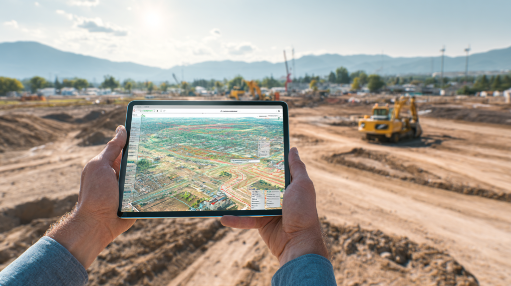
A strong SUP starts by mapping what must be protected (public right-of-way, life-safety paths, utilities), what must be accessed (laydown, hoists, elevators, crane radius, fuel/charging), and what must flow (people, vehicles, materials). GIS makes this tangible: you can layer current site conditions, staging zones, and access control points; place temporary assets with geospatial accuracy; and see how your plan interacts with local constraints. As the site changes, updated drone/topo data rolls into your base map so the plan stays current.
AI becomes your “second set of eyes.” Feed it your look-ahead, crane picks, large-vehicle arrivals, and crew density forecasts; it flags high-risk overlaps—like when steel deliveries overlap with a concrete pour at the same gate or when scaffold moves compress an egress path. The output isn’t theory; it’s actionable changes to gate assignments, routes, or time windows—decisions you can push directly into scheduling and delivery workflows so the field actually feels the improvement.
Digital forms and checklists close the loop. Gate check-ins, hot work permits, lane closure approvals, and utility locates become structured data rather than ad-hoc paper. That means you can prove compliance, spot patterns (eg, recurring delays at Gate 2 on Tuesdays), and tune the plan proactively. With a shared home dashboard, stakeholders see the same map, schedule, and constraints, reducing the “I didn’t know” factor that leads to rework.
How do project teams establish the core SUP more effectively?
- Start with a single, version-controlled GIS base map; add layers for fencing, travel paths, crane envelopes, laydown, utilities, and egress.
- Link the base map to scheduling and deliveries so time windows and routes stay in sync.
- Collect field updates with mobile forms so changes propagate back to everyone.
Why does this matter for superintendents and GCs?
- It prevents avoidable conflicts (blocked hoists, closed gates, overlapped lane closures), keeps crews productive, and protects the critical path.
What new trends are improving this workflow?
- Drone/LIDAR updates to the GIS base weekly; AI that scans look-aheads for conflicts; logistics platforms that assign gates and enforce delivery windows automatically.
Top Features
- Version-controlled GIS base map tied to weekly look-ahead
- AI conflict checks on deliveries, crane picks, and access routes
- Mobile forms for permits, gate logs, and field changes
Top Benefits
- Fewer blocked paths and last-minute reroutes
- Faster coordination across trades and vendors
- Better documentation for safety and compliance
Best Practices
- Keep a single base map source-of-truth; avoid shadow copies
- Attach delivery windows and gate IDs to each PO/ticket
- Require photo/GPS confirmation for layout-critical updates
FAQ
Q: Why do construction teams use a GIS-driven SUP?
A: It turns a static PDF into a live, shared map that reflects current site constraints and feeds scheduling/logistics decisions.
Q: How does this improve coordination or ROI?
A: Reduced delays and fewer conflicts translate into saved crane time, fewer standby charges, and steadier crew utilization.
Q: Is this scalable for large projects?
A: Yes—cloud mapping and role-based access let big teams coordinate in real time while maintaining control.
Q: How does it enhance safety or compliance?
A: You can enforce protected paths, document permits, and verify lane closures and escorts with photos/forms.
Q: Where can contractors learn more on StruxHub?
A: Visit the blog hub for related planning and scheduling articles: https://struxhub.com/resources/blog/
A single, geospatial source-of-truth aligned with your schedule and deliveries turns the SUP into a living plan the field can actually follow.
Related StruxHub articles
- Best Guide to Geographic Information Systems (GIS) in Construction: How Location-Based Data Improves Construction Project Management
- Proven Construction Scheduling Techniques and Best Practices for On-Time Project Delivery; Construction Scheduling coverage
- Top Strategies and Cutting-Edge Tools for Mastering Construction Document Management; Document Management coverage
- Construction Data Analytics: The Power of Visualization and Automated Reporting; Analytics coverage
Related Links: https://struxhub.com/products/home/ • https://struxhub.com/products/forms/ • https://struxhub.com/resources/blog/

Coordinating Deliveries, Gates, and Routes with Time-Window Control
Deliveries are the heartbeat of site logistics—and the #1 way a good plan falls apart. A GIS-anchored SUP helps you specify which gates accept which vehicle types, the safest turn radii, escort requirements, and the most efficient haul path to laydown. Pair that with a logistics module that enforces time windows and capacity limits at each gate, and you prevent three box trucks from arriving to a one-lane alley during a concrete pour. The practical move is to integrate PO information, vendor contacts, and route assignments so the right people see the right instructions on their phones before wheels roll.
AI assists by spotting risk patterns in your delivery calendar—flagging overlaps with crane picks, noting when high-volume drywall runs collide with fireproofing spray, or recommending an alternate gate because a scaffold move will compress the route. When a last-minute city inspection closes a lane, the plan updates in the map, and scheduled deliveries get auto-notified with new staging or revised windows.
Finally, verification matters. Gate check-ins with photo and time stamp, “delivered to zone” confirmation, and exceptions logged with a dropdown reason code build a dataset your PM can use to negotiate fees or change practices. Over a project’s life, these small operational guardrails save weeks.
How are GCs and PMs adopting this workflow?
- They define gate capabilities in the GIS layer, connect them to gates in the deliveries tool, and require time windows for all heavy loads.
- They push turn-by-turn instructions and contact info to drivers and foremen via mobile.
What challenges does it solve for field coordination?
- Reduces traffic jams, standby charges, and unsafe backing maneuvers; protects egress and emergency access during peak activity.
How does it integrate with digital tools?
- Gate IDs, routes, and staging zones live in the map; scheduled windows live in the deliveries module; both reference the same job phases in the schedule.
Top Features
- Gate capacity limits and time-window enforcement
- Route instructions with map waypoints and restricted zones
- Auto-notifications for changes, plus driver/foreman contact handoff
Top Benefits
- Fewer missed windows and standby claims
- Safer routing around live work and pedestrians
- Predictable material flow that aligns with task starts
Best Practices
- Tag every delivery with gate ID, route, and escort need
- Reserve windows for large loads at least 72 hours out
- Log exceptions with reason codes to drive improvements
FAQ
Q: What problem does this solve on modern jobsites?
A: It prevents the delivery pile-ups and unsafe improvisation that cascade into delays.
Q: What measurable results do teams see?
A: Lower standby and re-delivery costs, smoother crew utilization, and more predictable progress tracking.
When routes, gates, and time windows are mapped and enforced, material flow supports—not disrupts, the work.
Related StruxHub articles
- Construction Delivery: Best Practices for Effective Delivery Scheduling in Construction Projects; Delivery Scheduling
- Mastering Delivery Scheduling in Construction: Essential Techniques and Best Tools; Delivery Scheduling
- StruxHub Streamlines Construction Material Deliveries with Advanced Scheduling and Coordination Tools; Deliveries
Related links: https://struxhub.com/products/deliveries/ • https://struxhub.com/products/schedule/

Using AI Look-Aheads to De-Risk Crane Picks, Hoist Access, and Crew Density
Even with a solid map and tight delivery plan, high-impact activities—crane picks, hoist/elevator moves, core pours—introduce risk. AI helps you run “what-ifs” against your next two to six weeks of work: it scans planned deliveries, crew counts, and access paths to identify conflicts like a steel pick scheduled while the façade swing stage blocks the hoist landing, or a large MEP set arriving during a lane closure. The value is time: you learn about the conflict while it’s cheap to fix—before permits are booked and subcontractor crews are on the way.
Practically, this looks like connecting your look-ahead (by area, level, or zone) to your schedule and deliveries modules, then letting the AI surface collision candidates with simple, human-readable justifications. From there, you can shuffle windows, move staging, or flip sequences to keep the critical path intact. Because the findings are visualized on the map—highlighted paths, blocked zones, crane envelopes—the discussion in coordination meetings gets faster and more decisive.
For daily control, give superintendents a lightweight checklist: verify protected egress paths in impacted zones, confirm hoist reservations, and double-check escort needs for oversized loads. Turn those checks into mobile forms so exceptions become data, not anecdotes. Over time, you build playbooks tailor-made to your site type—hospitals, data centers, campuses—so your next project starts smarter.
Why are leading contractors prioritizing AI-assisted logistics in 2025?
- Projects are larger, sites are tighter, and public interfaces are stricter. AI scales human foresight so you catch more conflicts earlier.
How does automation enhance specific tasks?
- It auto-flags delivery overlaps with crane picks, warns when crew density will exceed a stairwell’s safe throughput, and suggests gate swaps during lane closures.
What field challenges does integration solve?
- It shortens coordination meetings, reduces rework, and stabilizes weekly work plans by aligning logistics to the schedule you actually intend to build.
Top Features
- AI conflict detection across schedule, deliveries, and GIS layers
- Visual highlights for blocked routes and crane envelopes
- One-tap mitigations (window shifts, gate swaps, staging moves)
Top Benefits
- Fewer day-of surprises; more reliable progress
- Safer hoist/elevator access and fewer near-misses
- Stronger evidence for city/owner coordination
Best Practices
- Review AI flags in weekly coordination; assign owners on the spot
- Convert critical checks into trackable mobile forms
- Store mitigations as playbook templates per project type
FAQ
Q: Is this relevant for small and mid-sized contractors?
A: Yes—start with one gate, one hoist, and high-impact deliveries; scale to more assets as the benefits compound.
Q: How does it affect superintendent routines?
A: It reduces firefighting by surfacing conflicts earlier, so your day is spent executing a plan—not rebuilding it at 6 a.m.
AI look-aheads turn your schedule and map into a proactive risk radar for the next two to six weeks.
Related StruxHub articles
- How to Choose the Top Construction Scheduling Software for Field Teams; Scheduling
- Real-Time Performance Tracking: Leveraging Dashboards and Metrics in Construction Projects Using StruxHub; Analytics
- The Best Guide to Drones in Construction: Transforming Site Management and Jobsite Efficiency; Drones
Related links: https://struxhub.com/products/schedule/ • https://struxhub.com/products/forms/ • https://struxhub.com/resources/blog/
StruxHub: Revolutionizing Project Management in Large Commercial Construction
Integrating Digital Systems and Data for Seamless Field Execution
Behind every great site utilization plan lies a network of digital systems working together—scheduling, deliveries, documents, and field reporting. Integration is what transforms data from fragmented spreadsheets into actionable insights. When your GIS base map links directly with StruxHub’s scheduling, deliveries, and forms modules, every update in one system automatically syncs across the others. That means fewer manual calls, less guesswork, and a consistent operational picture for all stakeholders.
For project managers, the key is adopting a shared “data backbone.” Start with your 3-week look-ahead and import it into the scheduling tool, then align it with your delivery windows and field forms. The GIS overlay acts as your visual validation layer—showing where equipment, staging, and crews intersect. With each submission, field teams generate real-time data points (timestamps, photos, coordinates), which flow back to dashboards for review. These are no longer static checklists—they’re automated reports ready for owner meetings, city inspectors, or internal QA.
When integrations are in place, field execution feels smoother. Crews check their task zones on mobile maps, drivers receive gate confirmations instantly, and foremen log issues without leaving the work area. This reduces delays, enhances accountability, and improves forecasting. A connected ecosystem also scales across multiple jobs—allowing regional managers to compare resource utilization and logistics efficiency across sites.
What systems make this effective?
- GIS mapping integrated with scheduling, deliveries, and forms modules
- Cloud data storage and role-based access controls
- Automated notifications linking field inputs with office dashboards
How can data and reporting improve execution?
- By transforming checklists into analytics, enabling faster trend recognition and better resource allocation.
What does a successful rollout look like?
- All departments—field, office, safety, vendors—see the same real-time data feed, minimizing errors and redundant work.
Top Features
- Unified data backbone connecting scheduling, forms, and deliveries
- Real-time dashboards for visibility and reporting
- Seamless mobile-to-office synchronization
Top Benefits
- Reduced data entry time and fewer communication errors
- Better forecasting through live analytics
- Consistent compliance documentation
Best Practices
- Start with one pilot project to fine-tune workflows
- Define clear data ownership (who updates what, and when)
- Audit integrations quarterly to prevent drift
FAQ
Q: What are common mistakes teams make during adoption?
A: Launching all integrations at once without clear roles or workflows. A phased rollout ensures stability.
Q: How does this connect to existing project-management tools?
A: StruxHub’s modules sync easily with common scheduling formats and field reporting workflows.
With the right integrations, your SUP evolves from a plan on paper into a self-updating, data-driven operations hub.
Related StruxHub articles
- Construction Data Analytics: How to Turn Raw Jobsite Data into Actionable Insights; Analytics
- How Construction Command Centers Help GCs Centralize Field Data and Crew Coordination; Command Centers
- Top Real-Time Construction Dashboards for Jobsite Visibility and Project Tracking; Dashboards
Related links: https://struxhub.com/products/home/ • https://struxhub.com/products/schedule/ • https://struxhub.com/products/forms/
Emerging Trends Transforming Site Utilization Planning in 2025 and Beyond
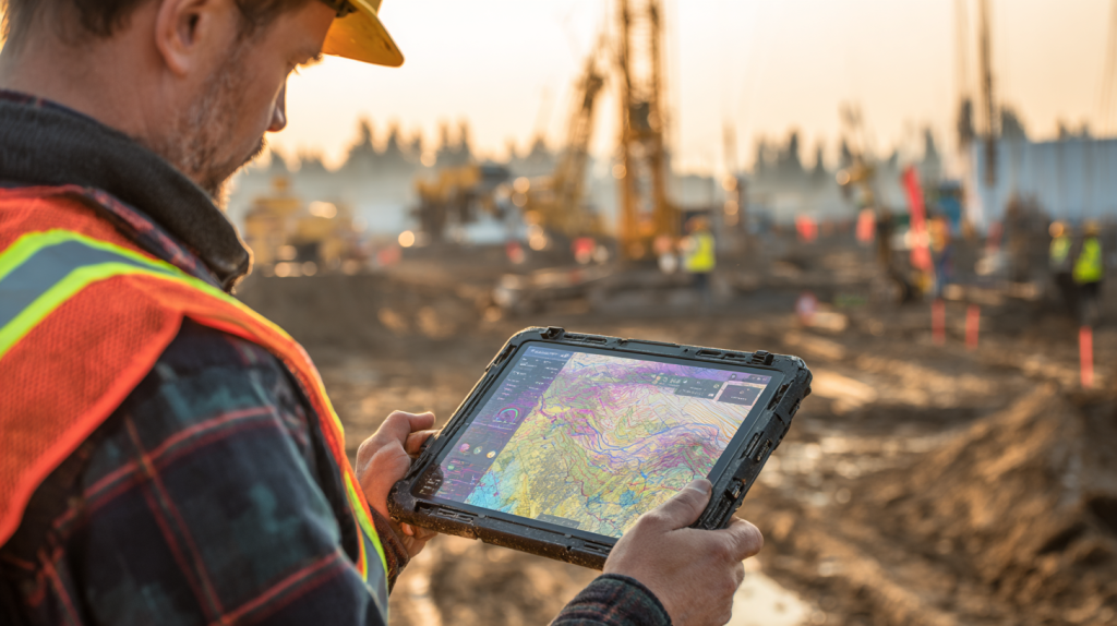
The construction landscape is shifting fast. Artificial intelligence, automation, and GIS-enabled analytics are converging to redefine how superintendents and project managers visualize, plan, and control space utilization. In 2025, leading firms are experimenting with predictive logistics—AI models that forecast material congestion weeks in advance—and dynamic site plans that update automatically when weather, deliveries, or permits change. The trend is moving toward “self-healing” construction data, where conflicts are identified and resolved before anyone steps foot on site.
Drones and real-time sensors feed live data back into GIS maps, turning them into digital twins of active jobsites. Instead of guessing crane reach or laydown availability, teams see up-to-date visuals with machine learning models predicting when each zone will free up. Automation doesn’t replace field experience—it augments it, allowing teams to simulate scenarios before making costly changes in real life.
Companies adopting AI-assisted logistics also see stronger sustainability outcomes. Optimized haul routes reduce idling and emissions, while predictive scheduling minimizes rework and material waste. These gains aren’t just environmental—they’re financial. Every minute saved in material handling translates into measurable ROI.
What new trends are influencing this workflow?
- Predictive AI for logistics congestion forecasting
- Drone-based GIS updates for near real-time site visibility
- Digital twins that model equipment and crew movement
How is AI reshaping this function?
- By suggesting alternate staging zones, flagging access conflicts, and recalibrating schedules automatically.
What future innovations should contractors prepare for?
- Voice-controlled field inputs, autonomous delivery routing, and AR overlays tied to GIS coordinates.
Top Features
- Predictive modeling for logistics bottlenecks
- Drone imagery integrated into GIS visualization
- Real-time digital twin dashboards
Top Benefits
- Early risk detection and faster planning cycles
- Reduced idle time for cranes and crews
- Lower emissions and material waste
Best Practices
- Train teams on AI-assisted workflows before deployment
- Use drone updates at least weekly for evolving sites
- Integrate sustainability metrics into SUP KPIs
FAQ
Q: How quickly are firms adopting these innovations?
A: Adoption is accelerating—mid-size GCs are already piloting predictive logistics and drone mapping in 2025.
Q: Does AI replace field experience?
A: No. It amplifies human judgment by surfacing data insights faster and more accurately.
By blending GIS, AI, and logistics automation, contractors move from reactive coordination to proactive control.
Related StruxHub articles
- Best Guide to AI in Construction Project Management: How Smart Tools Are Improving Construction Site Productivity; AI
- How General Contractors Use Real-Time Scheduling Software to Keep Projects Moving; Scheduling
Related links: https://struxhub.com/products/schedule/ • https://struxhub.com/resources/blog/

StruxHub
Experience the power of StruxHub today and witness firsthand how it can revolutionize your construction operations.
Turning Data into Performance: Long-Term Implementation and Profitability
A strong SUP doesn’t just manage today’s logistics—it compounds value over the life of the project and beyond. When historical GIS, logistics, and AI datasets are archived and analyzed, they become a training library for future jobs. You can measure how long specific gates caused delays, which staging zones created the most congestion, and how accurate your delivery forecasts were. This feedback loop informs better preconstruction planning and more realistic scheduling in future pursuits.
Long-term adoption also strengthens profitability. Fewer idle hours, reduced rework, and improved safety translate to tangible savings. By digitizing workflows early—through StruxHub’s forms and reporting tools—companies capture operational data automatically rather than manually. Over time, these insights help predict risks and optimize workforce allocation.
KPIs matter. The best-performing firms track metrics such as delivery punctuality, gate utilization rates, crane idle time, and field report completion rates. When linked to StruxHub’s dashboards, these metrics visualize trends across multiple projects. The ability to spot underperforming areas early makes the difference between catching up and staying ahead.
How can teams implement this effectively?
- Roll out one module at a time (schedule, deliveries, then forms) for smoother adoption.
- Establish performance KPIs and review them weekly during look-ahead meetings.
- Create a data archive strategy for lessons learned and future benchmarking.
What KPIs define success?
- Delivery punctuality, crew productivity, safety inspection completion, and schedule adherence percentages.
How does long-term adoption affect profitability?
- Every percentage point of improved efficiency saves thousands in labor, fuel, and rework costs across multi-year programs.
Top Features
- Multi-project dashboards consolidating SUP data
- Historical analytics and lessons-learned library
- Role-based metrics tracking for accountability
Top Benefits
- Continuous improvement and faster project ramp-up
- Reduced downtime and material waste
- Stronger preconstruction planning for future bids
Best Practices
- Review KPIs in coordination meetings every two weeks
- Use lessons-learned reports for training new teams
- Reward field crews that meet or exceed SUP goals
FAQ
Q: How long does it take to see measurable ROI?
A: Most teams notice improvements within 2–3 months once deliveries, scheduling, and forms are unified.
Q: What are the most important success factors?
A: Leadership consistency, clear data ownership, and steady feedback loops drive long-term results.
A well-implemented SUP becomes an asset class of its own—improving every project that follows.
Related StruxHub articles
- Best Guide to Construction Risk Management: How Top Contractors Control Jobsite Risk and Improve Field Accountability; Risk Management
- How Construction Command Centers Help GCs Centralize Field Data and Crew Coordination; Command Centers
- How AI Tools Are Automating Daily Construction Reports for Superintendents; AI Tools
Related links: https://struxhub.com/products/home/ • https://struxhub.com/products/forms/ • https://struxhub.com/resources/blog/
StruxHub
Discover how StruxHub can revolutionize your construction management. Contact us today!
How StruxHub Supports Contractors and Project Teams in Site Utilization Planning
Creating a truly efficient construction site utilization plan doesn’t just rely on good mapping or AI forecasts — it depends on the daily collaboration between field teams, vendors, and office staff. That’s exactly where StruxHub bridges the gap. The platform brings GIS-style clarity, logistics coordination, and scheduling visibility together in one central hub designed for general contractors and superintendents who manage complex field operations.
With StruxHub Home, project managers gain a unified dashboard showing every active project, key milestones, and open tasks at a glance. Its real-time data sync keeps information flowing seamlessly between teams, ensuring everyone sees the same updates without waiting for email threads or printed site plans. The Scheduling module connects project phases, trade activities, and manpower forecasts in one interface — so look-aheads, gate assignments, and equipment reservations are always up to date.
Material coordination becomes simpler through StruxHub Deliveries, which assigns gates, time windows, and routes directly to each delivery ticket. Superintendents can visualize every truck’s arrival against the current site plan, preventing pile-ups and reducing standby fees. Meanwhile, StruxHub Forms digitizes daily reports, inspection logs, and permits, allowing field teams to capture photos, notes, and status updates that sync instantly with the office. The result is faster communication, cleaner documentation, and improved compliance tracking.
Because StruxHub’s modules share the same real-time data structure, updates made in one area — like a delayed delivery — automatically reflect in related schedules or site layouts. This level of coordination not only reduces rework but also creates a digital record that helps contractors continuously refine future site utilization strategies.
For project teams looking to stay on schedule, reduce congestion, and make smarter decisions backed by data, StruxHub delivers the clarity and connection every modern jobsite needs.
With StruxHub, project teams gain real-time visibility, clear communication, and the confidence to deliver every build on schedule.
Useful links:
https://struxhub.com/products/home/
https://struxhub.com/products/deliveries/
https://struxhub.com/products/forms/
https://struxhub.com/products/schedule/
https://struxhub.com/resources/blog/

Unlock the Full Potential of Your Construction Projects with StruxHub
StruxHub enhances efficiency and coordination across all project phases, providing a single source of truth that eliminates silos and fosters collaboration. Real-time updates, financial management tools, and seamless commvunication features ensure that all team members and stakeholders are aligned and informed, reducing the risk of errors and delays. With comprehensive solutions for document management, risk mitigation, and quality control, StruxHub maintains project integrity and safety, while mobile access and integration capabilities further enhance project flexibility and efficiency.
StruxHub’s Key Features and Benefits:
- Advanced Delivery Management: Automate and optimize your delivery schedules, ensuring materials arrive just in time, every time.
- Site Communication: Utilize georeferenced maps and instant messaging to keep every team member informed and aligned.
- Construction Materials Management: Track inventory levels and manage materials procurement with ease, reducing waste and avoiding project delays.
- Construction Safety & Inspection Workflows: Implement customizable mobile forms for conducting safety inspections and managing compliance documentation effortlessly.
- Short-Term Scheduling: Visualize project tasks with detailed floor plans, linking each activity to specific locations for better planning accuracy.
- Construction Resource Management: Efficiently allocate personnel and equipment, maximizing productivity and reducing idle time.
StruxHub’s Product Offering:
- StruxHub Deliveries: Simplifies the coordination of incoming deliveries, ensuring materials and equipment are precisely timed to project needs.
- StruxHub Logistics: Offers intelligent site logistics planning, from crane scheduling to space allocation, for smoother operations.
- StruxHub Safety: Elevates on-site safety standards with easy-to-use tools for inspections, permits, and incident reporting.
- StruxHub Scheduling: Enhances project timelines with intuitive scheduling tools that ensure tasks are completed efficiently and on time.
With StruxHub, construction companies can look forward to a streamlined, more efficient project execution that delivers on time and within budget. Embrace the power of innovation and take your construction projects to the next level.
Don’t miss out on the opportunity to optimize your construction management processes with StruxHub. Sign up for a free demo today. Let’s build smarter, together.